Between the dense sands of the Victorian District and the soft marsh-edge clays near Thunderbolt, the ground beneath Savannah shifts dramatically within just a few blocks. After opening dozens of pits across Chatham County, our team has seen firsthand how the Pleistocene terrace deposits and recent alluvial fills create two entirely different excavation behaviors less than a mile apart. An exploratory test pit lets you see the stratigraphy directly, measure the seasonal water table at roughly 4 to 7 feet below grade, and decide on foundation depths before the backhoe even leaves the site. When the IBC requires a bearing stratum verified by visual inspection, this method delivers answers that a drill rig alone cannot, especially where the SPT drilling data needs ground-truthing against what the eye can confirm.
Opening a test pit in the Coastal Plain means confronting the water table directly — if you cannot control it, you cannot log it accurately.
Method and coverage
Regional considerations
IBC Section 1803 requires that the classification of soil be based on adequate subsurface exploration; in Savannah's lower-lying parcels — particularly those within the FEMA AE flood zone that covers much of the city south of Bay Street — a visual-only judgment from a drill cutting is insufficient. The test pit provides a continuous face where thin seams of organic material, buried topsoil, or old marsh deposits become obvious. We have located undocumented fill layers containing brick fragments and oyster shell just three feet below grade in the Starland District, material that would go unnoticed in a standard SPT sampler. Ignoring these lenses can lead to differential settlement complaints within the first two years of service. For sites within the 100-year floodplain, the pit also documents the seasonal high groundwater elevation, which directly affects footing design and the need for underslab drainage per ASCE 7 flood provisions.
Process video
Standards that apply
ASTM D2487 — Standard Practice for Classification of Soils for Engineering Purposes (Unified Soil Classification System), ASTM D2488 — Standard Practice for Description and Identification of Soils (Visual-Manual Procedure), IBC Section 1803 — Geotechnical Investigations, ASCE 7-22 Chapter 20 — Site Classification Procedure
Complementary services
Standard Exploratory Pit
Single pit up to 12 ft depth with stratigraphic log per ASTM D2488, Munsell color notation, moisture condition assessment, and photographic record of each exposed face. Suitable for single-family residential lots in the Ardsley Park and Parkside neighborhoods where bearing sands are expected.
Instrumented Test Pit Program
Multiple pits on a grid pattern with in-situ density testing by drive ring, pocket penetrometer and torvane readings per lift, plus groundwater monitoring over a 48-hour recovery period. Designed for commercial developments requiring IBC special inspection documentation.
Forensic Exposure and Fill Verification
Targeted pits to expose existing footings, verify undocumented fill thickness, or investigate distress symptoms. Includes sampling for laboratory classification and a written opinion on fill suitability per local Chatham County grading requirements.
Typical parameters
Q&A
What does an exploratory test pit cost in Savannah?
For a standard test pit in the Savannah area, budget between US$550 and US$810 per pit. The range accounts for mobilization distances within Chatham County, the depth specified (typically 8 to 14 feet), and whether groundwater pumping is required during logging. A multi-pit program on a single site reduces the per-unit cost because the backhoe and field crew are already on location.
How deep can a test pit go in Savannah before the water table becomes a problem?
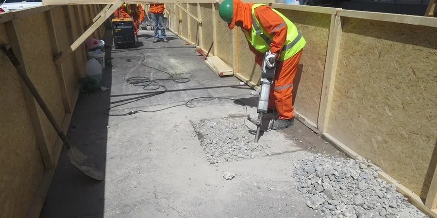
In central Savannah, the surficial water table is encountered between 4 and 7 feet below grade. Below that depth, the pit requires continuous dewatering with a trash pump. We can log to approximately 14 feet with a standard backhoe, but the face must be benched or sloped per OSHA excavation safety requirements once the depth exceeds 5 feet.
Do I still need drill rig borings if I have test pits?
Test pits and drill borings serve complementary roles. A pit gives you a continuous visual profile and lets you identify thin seams, fill layers, and the exact water table depth. A boring with SPT provides blow count data at greater depth and allows laboratory testing of undisturbed samples. On most commercial projects in Savannah, we recommend at least one test pit combined with a boring program to satisfy both IBC visual classification and the deeper bearing capacity evaluation.
How quickly can a test pit be scheduled and backfilled in Savannah?
Most residential test pits are excavated, logged, photographed, and backfilled within a single morning, typically 3 to 4 hours on site. We schedule early starts to beat the afternoon thunderstorms common in the Coastal Plain from May through September. Backfill is compacted in lifts with the excavator bucket, and the surface is restored to grade. A written log with photos is delivered within 48 hours.