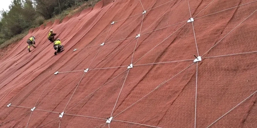
Much of Savannah sits on Pleistocene-age terrace deposits and younger marsh sediments, with a shallow water table rarely deeper than six feet near the coast. Any excavation deeper than a crawlspace or grading steeper than 2H:1V in these low-strength soils triggers a closer look at stability. The city’s subtropical climate delivers over 49 inches of rain a year, saturating the upper silty sands and accelerating erosion in drainage swales. When a developer re-grades a lot along the Vernon River or cuts into a sandy bluff near the Ogeechee, the risk of a rotational failure jumps sharply. We run limit-equilibrium analyses that incorporate pore-pressure buildup from the shallow aquifer and the loose-to-medium dense sands mapped across Chatham County. For deeper cuts in the underlying Hawthorn Formation, we often combine the stability model with a cone penetration test to define weak clay seams that don’t show up in standard borings.
In Savannah’s saturated coastal soils, a slope that stands dry can fail within 24 hours of a tropical storm if the analysis ignores transient pore pressure.
Method and coverage
Regional considerations
The most common trigger we see in Savannah is a contractor who opens a trench for a foundation wall during a wet August week and leaves it unsupported overnight. A 12-foot vertical cut in moist, silty sand won’t stand long; the suction that holds the face together dissipates within hours, and the lower portion slumps. We use a tracked CPT rig to push through the loose upper soils behind the crest and map exactly where the groundwater sits relative to the cut face. In a recent project off White Bluff Road, a planned 15-foot excavation for a stormwater vault required a temporary slope of 1.5H:1V with dewatering wells, based on the factor of safety dropping below 1.1 without them. Savannah’s geology doesn’t give much margin, so the stability analysis has to include the rainfall scenario that the IBC calls the probable maximum, not just the average month.
Standards that apply
IBC 2021 Chapter 18 (Soils and Foundations), ASCE 7-22 Section 11.8 (Seismic Slope Stability), ASTM D3080 (Direct Shear Test), ASTM D4767 (Consolidated-Undrained Triaxial), FHWA-NHI-05-123 (Soil Slope and Embankment Design)
Complementary services
Limit-Equilibrium Slope Modeling
We build 2D cross-sections using Spencer’s method and Bishop simplified routines, calibrated with lab shear-strength data from undisturbed Shelby-tube samples taken on-site. The model accounts for the perched water table common in Savannah’s layered sands and clays, and we run sensitivity checks on the fill weight that can be placed behind a bulkhead or retaining wall without triggering a deep-seated failure.
Cut-and-Fill Stability Review
When a site requires benching into a natural slope or placing engineered fill over soft marsh clay, we evaluate short-term undrained conditions and long-term drained conditions. Our reports specify compaction requirements, reinforcement layers, and bench geometry that meet the City of Savannah’s grading ordinance and IBC Chapter 18 criteria.
Typical parameters
Q&A
How much does a slope stability analysis cost for a residential lot in Savannah?
For a single-family lot with a proposed cut or fill up to 10 feet, the analysis typically runs between US$1,300 and US$4,410, depending on whether we need to add CPT soundings or laboratory shear tests. A more complex commercial site with multiple cross-sections and instrumentation recommendations will fall toward the upper end of that range.
What triggers the City of Savannah to require a slope stability report?
The city’s Development Services Department will request a geotechnical report with a slope stability chapter when grading exceeds five feet of cut or fill, when the proposed slope is steeper than 2H:1V, or when construction lies within 50 feet of a mapped floodplain or marsh front. The report must be signed and sealed by a Georgia-licensed professional engineer.
Can you analyze slopes in the soft marsh clays along the Savannah River?
Yes, those soft clays require an undrained analysis for short-term conditions and an effective-stress analysis for long-term settlement. We sample the clay with thin-wall Shelby tubes, run consolidated-undrained triaxial tests, and model the slope with staged construction to account for pore-pressure dissipation over time.
How do you account for hurricane rainfall in the stability model?
We input the 24-hour, 100-year rainfall depth from NOAA Atlas 14 for Chatham County, which is roughly 8.5 inches. The model applies this as a steady-state seepage condition with full saturation of the upper soil layers, and we check the factor of safety at the peak of the storm when pore pressures are highest.
Do you provide construction-phase monitoring for slopes in Savannah?
We can set up a monitoring plan that includes slope inclinometers, piezometers, and survey markers, and we visit the site at critical stages such as after heavy rain events or during deep excavation. The monitoring data lets us verify that the slope is performing as predicted and adjust the dewatering or shoring if needed.