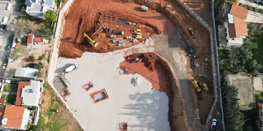
IBC Chapter 18 and ASCE 7 govern deep excavation design across Georgia, but Savannah imposes unique demands. The city sits on Pleistocene and Holocene coastal terrace deposits — loose sands, soft clays, and marl layers that shift under stress. Groundwater sits barely 1.5 meters below the surface across much of Chatham County. Any cut deeper than 3 meters must account for rapid base heave and low passive resistance. Our team runs site-specific soil characterization per ASTM D2487 and integrates in-situ permeability tests for dewatering system sizing before a single soldier pile goes in. The Savannah River's alluvial influence complicates the stratigraphy further. We pair triaxial testing with undrained strength profiles for the soft clays that govern wall embedment depth.
Savannah's groundwater at 1.5 meters depth turns a 4-meter cut into a continuous dewatering operation — design without permeability data is just guessing.
Method and coverage
Regional considerations
Savannah recorded its last significant seismic event in 1886 — the Charleston earthquake, magnitude 7.0, felt strongly here. Liquefaction potential in the loose coastal sands is real and documented in USGS hazard maps for Chatham County. A deep excavation without seismic earth pressure checks risks wall failure during a repeat event. Base heave in the soft clays is the other killer. We calculate factor of safety against basal heave using Terzaghi's method and cross-check with Bjerrum and Eide for narrow cuts. Tieback anchors in sand layers lose capacity if not designed for post-liquefaction strength loss. Our designs include a minimum factor of safety of 1.5 for static conditions and 1.1 for the seismic case per ASCE 7-22. Dewatering failure is the third risk — a single pump failure overnight floods the cut and erodes the passive zone. We specify dual-redundant wellpoint systems with automatic float switches.
Standards that apply
IBC 2021 Chapter 18 — Soils and Foundations, ASCE 7-22 — Minimum Design Loads for Buildings, ASTM D2487 — Unified Soil Classification System, ASTM D1586 — Standard Penetration Test, FHWA GEC No. 4 — Ground Anchors and Anchored Systems, FHWA NHI-05 — Soil Nail Walls
Complementary services
Shoring Wall Design
We design cantilever, anchored, and braced excavation support systems for cuts up to 15 meters. Wall sections use sheet piles or soldier beams with timber lagging depending on soil retention needs and groundwater control requirements in Savannah's coastal deposits.
Dewatering and Base Stability Analysis
Deep well and wellpoint dewatering layouts are sized from field permeability tests. We compute basal heave factors of safety and design jet grout plugs or deep soil mixing reinforcement where the soft Savannah clays cannot support the excavation base unassisted.
Construction-Phase Monitoring Plan
We prepare instrumented monitoring specifications: inclinometers behind the wall, piezometers for pore pressure, and optical survey points on adjacent structures. Trigger levels tie directly to the design assumptions for immediate contractor action.
Typical parameters
Q&A
What dewatering method works best for Savannah's high groundwater during deep excavation?
In downtown Savannah we typically specify a deep well system with submersible pumps for cuts exceeding 5 meters. For shallower work, a single-stage wellpoint system around the perimeter handles the 1.5-meter water table. The design always includes a backup pump on a separate power circuit and a standby generator connection.
How much does a geotechnical design package for a deep excavation in Savannah cost?
A complete design package — site investigation plan, shoring wall calculations, dewatering design, and sealed construction drawings — ranges from US$2,010 to US$8,270 depending on excavation depth, wall length, and complexity of the subsurface conditions encountered.
Do Savannah excavation designs need to consider seismic loading?
Yes. Even though Savannah is not in a high-seismicity zone, the 1886 Charleston earthquake demonstrated that strong ground motion can reach the coastal plain. ASCE 7-22 requires seismic earth pressure checks for permanent retaining walls and any excavation open longer than six months. We include pseudostatic analysis with a horizontal coefficient of 0.1g minimum for design.